
Make a donation
New Ferry topographic map
Click on the map to display elevation.
Make a donation
New Ferry
New Ferry is on the eastern side of the Wirral Peninsula, on the western bank of the River Mersey. The area is approximately 9 km (5.6 mi) south-south-east of the Irish Sea at New Brighton and about 10 km (6.2 mi) east-north-east of the Dee Estuary at Heswall. The area lies at an elevation of between 0–27 m (0–89 ft) above sea level.
Make a donation
About this map
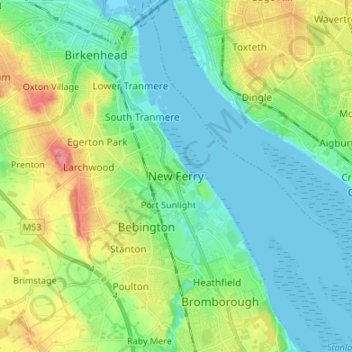
Name: New Ferry topographic map, elevation, terrain.
Average elevation: 25 m
Minimum elevation: -2 m
Maximum elevation: 84 m
Make a donation
Other topographic maps
Click on a map to view its topography, its elevation and its terrain.
Sheffield
Sheffield nestles on the eastern foothills of the Pennines and is sculpted by a dramatic hill-and-valley system formed where five rivers — the Don, Sheaf, Rivelin, Loxley and Porter — converge, producing steep-sided valleys and gritstone ridgelines with much of the urban area built directly onto hillsides…
Average elevation: 168 m
Make a donation
Bath
United Kingdom > England > Bath and North East Somerset
Bath is in the Avon Valley and is surrounded by limestone hills as it is near the southern edge of the Cotswolds, a designated Area of Outstanding Natural Beauty, and the limestone Mendip Hills rise around 7 miles (11 km) south of the city. The hills that surround and make up the city have a maximum altitude…
Average elevation: 100 m
North East England
North East England has a Marine west coast climate (generally found along the west coast of middle latitude continents) with narrower temperature ranges than the south of England and sufficient precipitation in all months. Summers and winters are mild rather than extremely hot or cold, due to the strong…
Average elevation: 165 m
Kent
Kent was also the location of the largest number of art schools in the country during the nineteenth century, estimated by the art historian David Haste, to approach two hundred. This is believed to be the result of Kent being a front line county during the Napoleonic Wars. At this time, before the invention…
Average elevation: 37 m
Make a donation
Birmingham
Birmingham is a snowy city relative to other large UK conurbations, due to its inland location and comparatively high elevation. Between 1961 and 1990 Birmingham Airport averaged 13.0 days of snow lying annually, compared to 5.33 at London Heathrow. Snow showers often pass through the city via the Cheshire gap…
Average elevation: 138 m
Make a donation
Exeter
United Kingdom > England > Devon
The city of Exeter was established on the eastern bank of the River Exe on a ridge of land backed by a steep hill. It is at this point that the Exe, having just been joined by the River Creedy, opens onto a wide flood plain and estuary which results in quite common flooding. Historically this was the lowest…
Average elevation: 56 m
East of England
The East of England region has the lowest elevation range in the UK. Twenty percent of the region is below mean sea level, most of this in North Cambridgeshire, Norfolk and on the Essex Coast. Most of the remaining area is of low elevation, with extensive glacial deposits. The Fens, a large area of reclaimed…
Average elevation: 39 m
Make a donation
Lake District National Park
The Lake District is a roughly circular upland massif, deeply dissected by a broadly radial pattern of major valleys which are largely the result of repeated glaciations over the last 2 million years. The apparent radial pattern is not from a central dome, but from an axial watershed extending from St Bees…
Average elevation: 206 m
Make a donation
London
London's topography is characterized by a gently rolling terrain shaped by the River Thames and its tributaries. The city lies within the London Basin, a natural depression bordered by higher grounds such as the North Downs to the south and the Chiltern Hills to the northwest. The Thames flows west to east,…
Average elevation: 66 m
Make a donation
Dartmoor National Park
United Kingdom > England > Devon
Rainfall tends to be associated with Atlantic depressions or with convection. In summer, convection caused by solar surface heating sometimes forms shower clouds and a large proportion of rainfall falls from showers and thunderstorms at this time of year. The wettest months are November and December and on the…
Average elevation: 239 m
Suffolk
The west of the county lies on more resistant Cretaceous chalk. This chalk is responsible for a sweeping tract of largely downland landscapes that stretches from Dorset in the south west to Dover in the south east and north through East Anglia to the Yorkshire Wolds. The chalk is less easily eroded so forms…
Average elevation: 35 m
Make a donation
Plymouth
The River Plym, which flows off Dartmoor to the north-east, forms a smaller estuary to the east of the city called Cattewater. Plymouth Sound is protected from the sea by the Plymouth Breakwater, in use since 1814. In the Sound is Drake's Island which is seen from Plymouth Hoe, a flat public area on top of…
Average elevation: 46 m
Make a donation
South East England
Near Weybridge are the UK headquarters of Sony with SSP Group (situated in Byfleet) and Procter & Gamble (next door to each other on The Heights Business Park near the former Brooklands racing circuit) with Kia Motors UK and Petroleum Geo-Services UK, and Gallaher Group (cigarettes) is to the north, next to…
Average elevation: 69 m
Make a donation
Derbyshire
Due to its central location in England and altitude range from 27 metres in the south to 636 metres in the north, Derbyshire contains many species at the edge of their UK distribution ranges. Some species with a predominantly northern British distribution are at the southern limit of their range, whilst others…
Average elevation: 144 m
Make a donation
City of Westminster
The area was historically part of the county of Middlesex. Whilst an important centre of royal authority from Saxon times, Westminster was not formally incorporated as a borough for local government purposes until 1900. However, it was declared a city in 1540 on the elevation of Westminster Abbey to being a…
Average elevation: 23 m
Make a donation
Cambridge
United Kingdom > England > Cambridge
The city, like most of the UK, has a maritime climate highly influenced by the Gulf Stream. Located in the driest region of Britain, Cambridge's rainfall averages around 570 mm (22.44 in) per year, around half the national average, with some years occasionally falling into the semi-arid (under 500 mm (19.69…
Average elevation: 18 m
Cornwall
The interior of the county consists of a roughly east–west spine of infertile and exposed upland, with a series of granite intrusions, such as Bodmin Moor, which contains the highest land within Cornwall. From east to west, and with approximately descending altitude, these are Bodmin Moor, Hensbarrow north…
Average elevation: 55 m
Make a donation
Surrey
United Kingdom > England > Surrey
The highest elevation in Surrey is Leith Hill near Dorking. It is 295 m (968 ft) above sea level and is the second highest point in southeastern England after Walbury Hill in West Berkshire which is 297 m (974 ft).
Average elevation: 69 m
Make a donation
Warwick
United Kingdom > England > Warwickshire
Warwick experiences the usual English maritime climate, marked by a narrow temperature range, mild winters and cool summers. The nearest official Met Office weather station is at Wellesbourne, about 6 miles (10 km) south of the town centre and at a similar elevation. The absolute maximum temperature (also the…
Average elevation: 87 m
Make a donation
Yorkshire
In Yorkshire there is a very close relationship between the major topographical areas and the geological period in which they were formed. The Pennine chain of hills in the west is of Carboniferous origin. The central vale is Permo-Triassic. The North York Moors in the north-east of the county are Jurassic in…
Average elevation: 130 m
Make a donation
Stoke-on-Trent
In 1919, the borough proposed to expand further and annex the neighbouring borough of Newcastle-under-Lyme and the Wolstanton United Urban District, both to the west of Stoke. This never took place, due to strong objections from Newcastle Corporation. A further attempt was made in 1930, with the promotion of…
Average elevation: 168 m
Make a donation
Cambridge
United Kingdom > England > Cambridgeshire
The city, like most of the UK, has a maritime climate highly influenced by the Gulf Stream. Located in the driest region of Britain, Cambridge's rainfall averages around 570 mm (22.44 in) per year, around half the national average, The driest recent year was in 2011 with 380.4 mm (14.98 in) of rain at the…
Average elevation: 18 m
Hertfordshire
Elevations are higher in the north and west, reaching more than 800 feet (240 m) in the Chilterns near Tring. The county centres on the headwaters and upper valleys of the rivers Lea and the Colne; both flow south, and each is accompanied by a canal. Hertfordshire's undeveloped land is mainly agricultural,…
Average elevation: 82 m
Make a donation
Crawley
United Kingdom > England > West Sussex
Crawley lies within the Sussex Weald, an area of highly variable terrain so that many microclimates of frost hollows, sun traps and windswept hilltops will be encountered over a short distance. During calm, clear periods of weather this allows for some interesting temperature variations, although most of the…
Average elevation: 80 m
Make a donation
Make a donation
Chilterns National Landscape
United Kingdom > England > Buckinghamshire
The highest point is at 267 m (876 ft.) above sea level at Haddington Hill near Wendover in Buckinghamshire; a stone monument marks the summit. The nearby Ivinghoe Beacon is a more prominent hill, although its altitude is only 249 m (817 ft.). It is the starting point of the Icknield Way Path and the Ridgeway…
Average elevation: 102 m
Connaught Water
United Kingdom > England > Essex > Epping Forest > Sewardstonebury
Average elevation: 57 m
Make a donation
Todmorden
United Kingdom > England > Calderdale
Todmorden Town Hall, which was designed in the Neo-Classical style, dominates the centre of the town. The building straddles the Walsden Water, a tributary of the River Calder, and was situated in both Lancashire and Yorkshire until the administrative county boundary was moved on 1 January 1888. Designed by…
Average elevation: 311 m
Make a donation
Make a donation
Farnham
United Kingdom > England > Surrey > Waverley
Farnham lies in the valley of the North Branch of the River Wey, which rises near Alton, merges with the South Branch at Tilford, and joins the River Thames at Weybridge. The mainly east-west alignment of the ridges and valleys has influenced the development of road and rail communications. The most prominent…
Average elevation: 100 m
Lincoln
United Kingdom > England > Lincolnshire
Lincoln lies 157 mi (253 km) north of London, at an altitude of 67 ft (20.4 m) by the River Witham up to 246 ft (75.0 m) on Castle Hill. It fills a gap in the Lincoln Cliff escarpment, which runs north and south through central Lincolnshire, with altitudes up to 200 feet (61 metres). The city lies on the River…
Average elevation: 29 m
Make a donation
St Albans
United Kingdom > England > Hertfordshire
The borough consisted of the ancient parish of St Albans (also known as the Abbey parish) and parts of the parishes of St Michael and St Peter. The borough was reformed by the Municipal Corporations Act 1835 to become a municipal borough, and the boundary was adjusted to additionally include part of the parish…
Average elevation: 103 m
London
London's topography is characterized by a gently rolling terrain shaped by the River Thames and its tributaries. The city lies within the London Basin, a natural depression bordered by higher grounds such as the North Downs to the south and the Chiltern Hills to the northwest. The Thames flows west to east,…
Average elevation: 66 m
Make a donation
Yorkshire and the Humber
In the Yorkshire and the Humber region, there is a very close relationship between the major topographical areas and the underlying geology. The Pennine chain of hills in the west is of Carboniferous origin. The central vale is Permo-Triassic. The North York Moors in the north-east of the region are Jurassic…
Average elevation: 120 m
Wimbledon Common
United Kingdom > England > London
Putney Heath is around 160 hectares (400 acres) in size and sits at approximately 45 metres (148 feet) above sea level. Because of its elevation, from 1796 to 1816 Putney Heath hosted a station in the shutter telegraph chain, which connected the Admiralty in London to its naval ships in Portsmouth. This was…
Average elevation: 35 m
Make a donation