
Thank you for supporting this site ❤️
Make a donation
Make a donation
Boston topographic map
Click on the map to display elevation.
Thank you for supporting this site ❤️
Make a donation
Make a donation
About this map
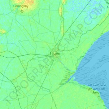
Name: Boston topographic map, elevation, terrain.
Location: Boston, Lincolnshire, England, United Kingdom (52.86280 -0.24671 53.08666 0.23855)
Average elevation: 3 m
Minimum elevation: -2 m
Maximum elevation: 14 m
Thank you for supporting this site ❤️
Make a donation
Make a donation
Other topographic maps
Click on a map to view its topography, its elevation and its terrain.