
Sævelandsvik topographic map
Interactive map
Click on the map to display elevation.
About this map
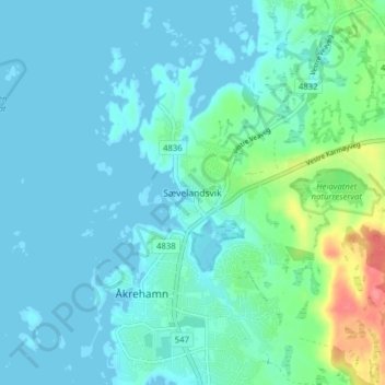
Name: Sævelandsvik topographic map, elevation, terrain.
Location: Sævelandsvik, Karmøy, Rogaland, 4275, Noorwegen (59.25126 5.17623 59.29126 5.21623)
Average elevation: 11 m
Minimum elevation: -2 m
Maximum elevation: 65 m
Other topographic maps
Click on a map to view its topography, its elevation and its terrain.