
Hunnedalen topographic map
Interactive map
Click on the map to display elevation.
About this map
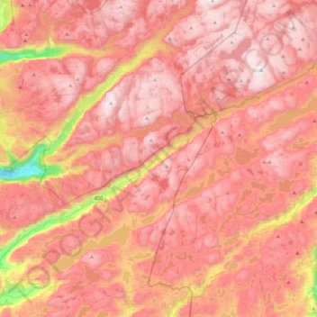
Name: Hunnedalen topographic map, elevation, terrain.
Location: Hunnedalen, Gjesdal, Rogaland, Noorwegen (58.78689 6.32368 58.91946 6.74147)
Average elevation: 759 m
Minimum elevation: 18 m
Maximum elevation: 1,128 m
Other topographic maps
Click on a map to view its topography, its elevation and its terrain.
Sævelandsvik
Sævelandsvik, Karmøy, Rogaland, 4275, Noorwegen
Average elevation: 11 m