
Paracale topographic map
Click on the map to display elevation.
About this map
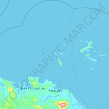
Name: Paracale topographic map, elevation, terrain.
Location: Paracale, Camarines Norte, Bicol Region, 4605, Philippines (14.19918 122.64061 14.67190 122.89276)
Average elevation: 11 m
Minimum elevation: -2 m
Maximum elevation: 743 m
Other topographic maps
Click on a map to view its topography, its elevation and its terrain.
Talisay
The fertile soil, topography (averaging about 10 metres (33 ft) above sea-level) and suitable climate are the main reasons why agriculture is the economic backbone of the town. Rice and coconut farming are the major agricultural activities for most of the barangays and fishing is the second thriving industry…
Average elevation: 10 m
Bicol Natural Park
Philippines > Camarines Norte > Basud
The Bicol Natural Park spreads across the Camarines Norte municipalities of Basud and Mercedes, and the Camarines Sur municipalities of Sipocot and Lupi. It is situated at an elevation of 536 metres (1,759 ft) above sea level bordered by the Tuaca River to the north, the agricultural lands of Sipocot and Lupi…
Average elevation: 191 m