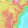
Periyar topographic map
Click on the map to display elevation.
Periyar
The southernmost part of the Cardamom Hills i.e. the source of Periyar River is a narrow valley extending south of Kumily. This is the southern extreme of the Periyar basin. It is less than 20 kilometres (12 mi) wide and is about 40 kilometres (25 mi) long. The upper catchments of Periyar extend as a wedge deep into the northeastern corner of the neighboring Pandalam Hills. This section of the Cardamom Hills extends deep into but is clearly separated from the Pandalam Hills. The main Western Ghats watershed line forming the eastern border of the Cardamom Hills is highest to the southeast of the Kumily Gap. Here the High Wavies branch off towards north-west into Tamil Nadu, with some peaks reaching elevations of over 1,900 metres (6,200 ft) along the border between Kerala and Tamil Nadu. Further south, the ridge along the watershed line is heavily forested. This part of the Cardamom Hills is called the Sivagiri Range and it extends south up to Chokkampatti Mala which is at the junction of Pamba and Periyar River basins. The southern boundary of the Cardamom Hills runs along a westerly spur hill starting from the Chokkampatti Mala which initially runs north and then turns northwest almost parallel to the Sivagiri Range. This ridge separates the basin of Pamba from Periyar. From its source near Chokkampatti Mala initially Periyar flows north between these two heavily forested ridges. The valley floor is at an elevation of 1,000 metres (3,300 ft) and the ridges on either side often reach 1,800 metres (5,900 ft). This valley of Periyar at its source and the valley of Kunthi River in the Silent Valley are the only two forested higher valleys in the Western Ghats left intact even now. The 925-square-kilometre (357 sq mi) Periyar Tiger Reserve is mostly within this southernmost part of the Cardamom Hills.
About this map
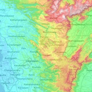
Name: Periyar topographic map, elevation, terrain.
Location: Periyar, Kerala, India (9.28671 76.16284 10.19601 77.31602)
Average elevation: 540 m
Minimum elevation: -5 m
Maximum elevation: 2,641 m
Other topographic maps
Click on a map to view its topography, its elevation and its terrain.
Western Ghats
The range starts near south of the Tapti river and runs approximately 1,600 km (990 mi) through the states of Gujarat, Maharashtra, Karnataka, Goa, Kerala and Tamil Nadu ending at Marunthuvazh Malai, Swamithope near the southern tip of India. These hills cover 160,000 km2 (62,000 sq mi) and form the catchment…
Average elevation: 2,225 m
Vagamon
Vagamon, due to its elevation and climate, has a unique ecosystem, leading to the emergence of rich natural vegetation, plant species, shola forests etc. From the early 20th century plantation crops like tea, coffee started. Vagamon hills are home to less explored flora and fauna. A faunal diversity study…
Average elevation: 866 m
Kannur
Kannur has an elevation of 1.02 metres or 3.3 feet along the coast of the Laccadive Sea, with a sandy coastal area. The city has an 8 kilometres (5.0 mi)-long seashore and a 3 kilometres (1.9 mi)-long beach at Payyambalam. Kannur is located north of Kozhikode, south of Kasargod and Mangalore, west of the…
Average elevation: 13 m
Thiruvananthapuram
India > Kerala > Thiruvananthapuram
Thiruvananthapuram is built on seven hills by the seashore and is at 8°30′N 76°54′E / 8.5°N 76.9°E / 8.5; 76.9 on the west coast, near the southern tip of mainland India. The city is on the west coast of India and is bounded by the Laccadive Sea to its west and the Western Ghats to its east.…
Average elevation: 33 m

Pathanamthitta
Pathanamthitta has an average elevation of 18 metres (62 ft) above sea level.
Average elevation: 63 m


Idamalayar Dam
The Idamalayar Dam is located on the Idamalayar River, a tributary of the Periyar River in Kerala. Edamalayar originates in the Anamala Hills at elevation of 2,520 metres (8,270 ft). The river is a perennial source draining a catchment area of 381 km2 (147 sq mi) with a topography of high relief. The catchment…
Average elevation: 257 m





Western Ghats
The range starts near south of the Tapti river and runs approximately 1,600 km (990 mi) through the states of Gujarat, Maharashtra, Karnataka, Goa, Kerala and Tamil Nadu ending at Marunthuvazh Malai near the southern tip of India. These hills cover 160,000 km2 (62,000 sq mi) and form the catchment area for…
Average elevation: 2,225 m






Temple Pond, Bhagavathi Padam, Angadippuram
India > Kerala > Perinthalmanna > Angadipuram
Average elevation: 45 m






Erattupetta
It has an average elevation of 36 metres (118 feet).
Average elevation: 78 m




Shoranur
India > Kerala > Ottappalam
Shoranur is located at 10°46′N 76°17′E / 10.77°N 76.28°E / 10.77; 76.28. It has an average elevation of 49 metres (160 feet).
Average elevation: 47 m
Periyar National Park Tiger Reserve
Periyar National Park lies in the middle of a mountainous area of the Cardamom Hills. In the north : The boundary commences from the point nearest to the Medaganam in the interstate boundary up to Vellimalai. and the east Thence the boundary follows the inter-state boundary from Vellimalai to Kallimalai Peak…
Average elevation: 929 m


Arakkulam
India > Kerala > Vaikom > Thalayolaparambu > Chundangakari vadachira colony
Average elevation: 6 m