Geolocate

Kvinnherad topographic map

Interactive map

Click on the map to display elevation.

About this map

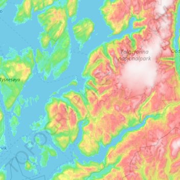
Name: Kvinnherad topographic map, elevation, terrain.

Location: Kvinnherad, Vestland, Norway (59.68611 5.56941 60.21709 6.48313)

Average elevation: 465 m

Minimum elevation: -3 m

Maximum elevation: 1,651 m

Other topographic maps

Click on a map to view its topography, its elevation and its terrain.

Vinnes

Norway > Vestland

Vinnes, Bjørnafjorden, Vestland, 5641, Norway

Average elevation: 39 m

Vik

Norway > Vestland

Vik, Vestland, Norway

Average elevation: 739 m

Odda

Norway > Vestland > Odda

Odda, Ullensvang, Vestland, 5750, Norway

Average elevation: 761 m

Sogndal

Norway > Vestland

Sogndal, Vestland, Norway

Average elevation: 725 m

Stryn

Norway > Vestland

Stryn, Vestland, Norway

Average elevation: 882 m

Etne

Norway > Vestland

Etne, Vestland, Norway

Average elevation: 703 m