
Thank you for supporting this site ❤️
Make a donation
Make a donation
Vinnes topographic map
Click on the map to display elevation.
Thank you for supporting this site ❤️
Make a donation
Make a donation
About this map
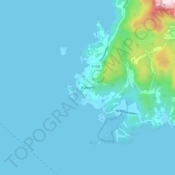
Name: Vinnes topographic map, elevation, terrain.
Location: Vinnes, Bjørnafjorden, Vestland, 5641, Norway (60.13536 5.56350 60.17536 5.60350)
Average elevation: 39 m
Minimum elevation: -9 m
Maximum elevation: 436 m
Thank you for supporting this site ❤️
Make a donation
Make a donation
Other topographic maps
Click on a map to view its topography, its elevation and its terrain.