
Inchiri topographic map
Interactive map
Click on the map to display elevation.
About this map
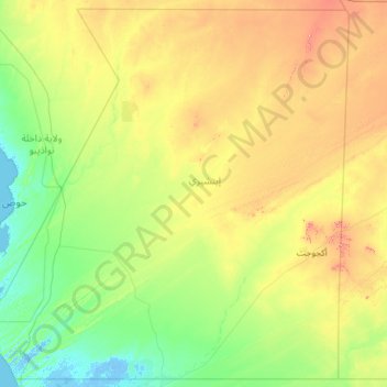
Name: Inchiri topographic map, elevation, terrain.
Location: Inchiri, Mauritania (19.00000 -16.54921 21.15085 -14.15448)
Average elevation: 87 m
Minimum elevation: -5 m
Maximum elevation: 408 m
Other topographic maps
Click on a map to view its topography, its elevation and its terrain.