
Ganzhou topographic map
Interactive map
Click on the map to display elevation.
About this map
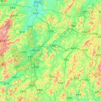
Name: Ganzhou topographic map, elevation, terrain.
Location: Ganzhou, Jiangxi, China (24.48885 113.90911 27.14679 116.63352)
Average elevation: 388 m
Minimum elevation: 43 m
Maximum elevation: 2,085 m
Other topographic maps
Click on a map to view its topography, its elevation and its terrain.
Lanting
China > Jiangxi > Hukou County > Junqiao
Lanting, Junqiao, Hukou County, Jiangxi, China
Average elevation: 23 m
Lian River
China > Jiangxi > Yudu County
Lian River, Yudu County, Ganzhou, Jiangxi, China
Average elevation: 243 m
Ruichang City
China > Jiangxi > Ruichang City
Ruichang City, Jiujiang, Jiangxi, China
Average elevation: 136 m