
Thank you for supporting this site ❤️
Make a donation
Make a donation
Fuzhou City topographic map
Click on the map to display elevation.
Thank you for supporting this site ❤️
Make a donation
Make a donation
About this map
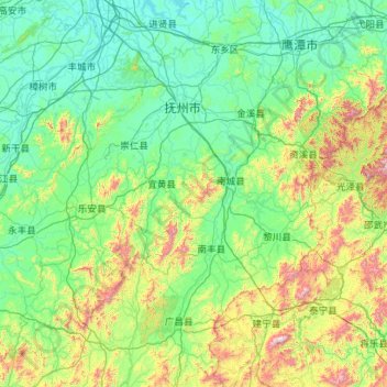
Name: Fuzhou City topographic map, elevation, terrain.
Location: Fuzhou City, Jiangxi, China (26.50196 115.58731 28.49684 117.30092)
Average elevation: 271 m
Minimum elevation: 12 m
Maximum elevation: 1,773 m
Thank you for supporting this site ❤️
Make a donation
Make a donation
Other topographic maps
Click on a map to view its topography, its elevation and its terrain.