
تيبستي topographic map
Interactive map
Click on the map to display elevation.
About this map
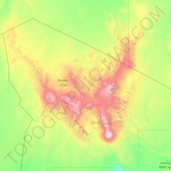
Name: تيبستي topographic map, elevation, terrain.
Location: تيبستي, Tibesti تيبستي, Tschad (18.71887 15.78600 24.01419 20.17188)
Average elevation: 801 m
Minimum elevation: 308 m
Maximum elevation: 3,353 m
Other topographic maps
Click on a map to view its topography, its elevation and its terrain.