

Connecticut topographic maps
Click on a map to view its topography, its elevation and its terrain.


Killingly
United States > Connecticut > Northeastern Connecticut Planning Region
Average elevation: 131 m
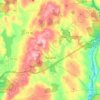
Tolland
United States > Connecticut > Capitol Planning Region
Tolland's climate is classified as warm summer continental (Dfb), as is typical of the eastern hills of Connecticut. The area enjoys some characteristics hot-summer continental climate (Dfa) due to a relatively high July mean temperature of 70.7 °F (21.5 °C), which is very close to the threshold of 71.6 °F…
Average elevation: 201 m


Norfolk
United States > Connecticut > Northwest Hills Planning Region
According to the United States Census Bureau, the town has a total area of 46.4 square miles (120.2 km2), of which 45.3 square miles (117.4 km2) are land and 1.1 square miles (2.9 km2), or 2.38%, are water. The town is located in the Litchfield Hills portion of the Appalachian mountain range. Norfolk's…
Average elevation: 404 m

Hawks Nest Beach
United States > Connecticut > Lower Connecticut River Valley Planning Region > Old Lyme > Sound View
Average elevation: 7 m

West District
United States > Connecticut > Capitol Planning Region > Farmington
Average elevation: 92 m

Northford
United States > Connecticut > South Central Connecticut Planning Region > North Branford
Average elevation: 71 m

Canterbury
United States > Connecticut > Northeastern Connecticut Planning Region
Average elevation: 90 m

Lyme
United States > Connecticut > Lower Connecticut River Valley Planning Region
Average elevation: 49 m

Pecks Mill
United States > Connecticut > Greater Bridgeport Planning Region > Stratford
Average elevation: 23 m

West Norwalk
United States > Connecticut > Western Connecticut Planning Region > Norwalk
Average elevation: 50 m

Stevenson
United States > Connecticut > Greater Bridgeport Planning Region > Monroe
Average elevation: 106 m


Central Village
United States > Connecticut > Northeastern Connecticut Planning Region > Plainfield
Average elevation: 69 m


Marble Dale
United States > Connecticut > Northwest Hills Planning Region > Washington
Average elevation: 249 m

Nichols
United States > Connecticut > Greater Bridgeport Planning Region > Trumbull
Average elevation: 59 m

Bakersville
United States > Connecticut > Northwest Hills Planning Region > New Hartford
Average elevation: 245 m

White Hills
United States > Connecticut > Naugatuck Valley Planning Region > Shelton
Average elevation: 124 m

Killingly Center
United States > Connecticut > Northeastern Connecticut Planning Region > Killingly > Dayville
Average elevation: 109 m

West Stafford
United States > Connecticut > Capitol Planning Region > Stafford
Average elevation: 203 m
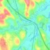
Centerbrook
United States > Connecticut > Lower Connecticut River Valley Planning Region > Essex
Average elevation: 34 m

Hamburg
United States > Connecticut > Lower Connecticut River Valley Planning Region > Lyme
Average elevation: 49 m

Bowers Hill
United States > Connecticut > Naugatuck Valley Planning Region > Oxford > Riverside
Average elevation: 125 m

Ridgewood
United States > Connecticut > Lower Connecticut River Valley Planning Region > Clinton
Average elevation: 2 m

Southport
United States > Connecticut > Greater Bridgeport Planning Region > Fairfield
Average elevation: 11 m

Daniels Mill
United States > Connecticut > Western Connecticut Planning Region > New Canaan
Average elevation: 100 m

Jordan Village
United States > Connecticut > Southeastern Connecticut Planning Region > Waterford
Average elevation: 27 m

Skinnerville
United States > Connecticut > Lower Connecticut River Valley Planning Region > East Hampton
Average elevation: 131 m

Wangum Village
United States > Connecticut > Northwest Hills Planning Region > Canaan
Average elevation: 235 m

Beaver Brook
United States > Connecticut > Western Connecticut Planning Region > Danbury
Average elevation: 119 m


Nelsons Corner
United States > Connecticut > Northwest Hills Planning Region > Winchester
Average elevation: 275 m

Silvermine
United States > Connecticut > Western Connecticut Planning Region > Norwalk
Average elevation: 66 m
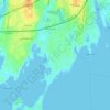
Old Greenwich
United States > Connecticut > Western Connecticut Planning Region > Greenwich
Average elevation: 12 m

Mill Plain
United States > Connecticut > Greater Bridgeport Planning Region > Fairfield > Southport
Average elevation: 16 m

Hurds Corner
United States > Connecticut > Western Connecticut Planning Region > New Milford
Average elevation: 148 m

Cannondale
United States > Connecticut > Western Connecticut Planning Region > Wilton
Average elevation: 110 m

Platts Mills
United States > Connecticut > Naugatuck Valley Planning Region > Naugatuck > Union City
Average elevation: 120 m

Germantown
United States > Connecticut > Western Connecticut Planning Region > Danbury
Average elevation: 121 m

North Thompsonville
United States > Connecticut > Capitol Planning Region > Enfield
Average elevation: 31 m

Aspetuck
United States > Connecticut > Greater Bridgeport Planning Region > Easton
Average elevation: 83 m

Winnipauk
United States > Connecticut > Western Connecticut Planning Region > Norwalk
Average elevation: 51 m

Nepaug
United States > Connecticut > Northwest Hills Planning Region > New Hartford
Average elevation: 222 m

South Wethersfield
United States > Connecticut > Capitol Planning Region > Wethersfield > Griswoldville
Average elevation: 22 m

Whitneyville
United States > Connecticut > South Central Connecticut Planning Region > Hamden
Average elevation: 21 m

Cranbury
United States > Connecticut > Western Connecticut Planning Region > Norwalk
Average elevation: 41 m

Browns Corner
United States > Connecticut > Northwest Hills Planning Region > New Hartford
Average elevation: 212 m

Ledyard Center
United States > Connecticut > Southeastern Connecticut Planning Region > Ledyard
Average elevation: 72 m

Lakeville
United States > Connecticut > Northwest Hills Planning Region > Salisbury
Average elevation: 259 m

Roxbury Falls
United States > Connecticut > Northwest Hills Planning Region > Roxbury
Average elevation: 150 m

Burnside
United States > Connecticut > Capitol Planning Region > East Hartford
Average elevation: 24 m

Plantsville
United States > Connecticut > Capitol Planning Region > Southington
Average elevation: 57 m

Willington Hill
United States > Connecticut > Capitol Planning Region > Willington
Average elevation: 197 m

North Woodbury
United States > Connecticut > Naugatuck Valley Planning Region > Woodbury
Average elevation: 115 m

Four Corners
United States > Connecticut > Capitol Planning Region > Terramuggus
Average elevation: 143 m

East Morris
United States > Connecticut > Northwest Hills Planning Region > Morris
Average elevation: 294 m

North Mianus
United States > Connecticut > Western Connecticut Planning Region > Greenwich > Mianus
Average elevation: 32 m

Fenwood
United States > Connecticut > Lower Connecticut River Valley Planning Region > Old Saybrook
Average elevation: 2 m

Clarks Village
United States > Connecticut > Southeastern Connecticut Planning Region > Stonington
Average elevation: 17 m

Drakeville
United States > Connecticut > Northwest Hills Planning Region > Torrington
Average elevation: 309 m

East Windsor Hill
United States > Connecticut > Capitol Planning Region > South Windsor
Average elevation: 16 m

East Glastonbury
United States > Connecticut > Capitol Planning Region > Glastonbury
Average elevation: 131 m

East Willington
United States > Connecticut > Capitol Planning Region > Willington
Average elevation: 196 m

Candlewood Lake Club
United States > Connecticut > Western Connecticut Planning Region > New Milford
Average elevation: 143 m

Laysville
United States > Connecticut > Lower Connecticut River Valley Planning Region > Old Lyme
Average elevation: 33 m

Brockway
United States > Connecticut > Lower Connecticut River Valley Planning Region > Lyme
Average elevation: 47 m

Taconic
United States > Connecticut > Northwest Hills Planning Region > Salisbury
Average elevation: 239 m
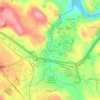
Sandy Hook
United States > Connecticut > Western Connecticut Planning Region > Newtown
Average elevation: 113 m

Lyons Plain
United States > Connecticut > Western Connecticut Planning Region > Weston
Average elevation: 86 m

Oronoque Hills North
United States > Connecticut > Greater Bridgeport Planning Region > Stratford > Oronoque
Average elevation: 47 m

Oronoque
United States > Connecticut > Greater Bridgeport Planning Region > Stratford
Average elevation: 37 m

Winchester Center
United States > Connecticut > Northwest Hills Planning Region > Winchester
Average elevation: 385 m

North Franklin
United States > Connecticut > Southeastern Connecticut Planning Region
Average elevation: 103 m

Durham Center
United States > Connecticut > Lower Connecticut River Valley Planning Region > Durham
Average elevation: 78 m

Huntington
United States > Connecticut > Naugatuck Valley Planning Region > Shelton
Average elevation: 111 m

West Torrington
United States > Connecticut > Northwest Hills Planning Region > Torrington
Average elevation: 270 m

Buckingham
United States > Connecticut > Capitol Planning Region > Glastonbury
Average elevation: 131 m


Giants Neck
United States > Connecticut > Southeastern Connecticut Planning Region > East Lyme
Average elevation: 9 m

Allyn Point
United States > Connecticut > Southeastern Connecticut Planning Region > Ledyard > Gales Ferry
Average elevation: 34 m


Manitock Spring
United States > Connecticut > Southeastern Connecticut Planning Region > Waterford > Oswegatchie
Average elevation: 26 m
Riverside
United States > Connecticut > Western Connecticut Planning Region > Greenwich > Old Greenwich
Average elevation: 13 m

Griswoldville
United States > Connecticut > Capitol Planning Region > Wethersfield
Average elevation: 34 m

Hadlyme
United States > Connecticut > Lower Connecticut River Valley Planning Region > Lyme
Average elevation: 45 m

North Coventry
United States > Connecticut > Capitol Planning Region > Coventry
Average elevation: 195 m

Chaffeeville
United States > Connecticut > Capitol Planning Region > Mansfield
Average elevation: 133 m

West Suffield
United States > Connecticut > Capitol Planning Region > Suffield
Average elevation: 59 m

Lanesville
United States > Connecticut > Western Connecticut Planning Region > New Milford
Average elevation: 106 m

Pleasant Valley
United States > Connecticut > Northwest Hills Planning Region > Barkhamsted
Average elevation: 192 m

North Haven Bridge
United States > Connecticut > South Central Connecticut Planning Region > North Haven
Average elevation: 22 m


Bartholomew Hill
United States > Connecticut > Northwest Hills Planning Region > Goshen
Average elevation: 426 m

Bunker Hill
United States > Connecticut > Lower Connecticut River Valley Planning Region > Killingworth
Average elevation: 135 m

Chestnut Hill
United States > Connecticut > Lower Connecticut River Valley Planning Region > Killingworth
Average elevation: 77 m

East Rive Beach
United States > Connecticut > South Central Connecticut Planning Region > Madison
Average elevation: 2 m

Haystack Mountain
United States > Connecticut > Northwest Hills Planning Region > Norfolk
Average elevation: 385 m