Germany topographic maps
Click on a map to view its topography, its elevation and its terrain.
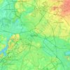
Berlin
Berlin straddles the banks of the River Spree, which flows into the River Havel (a tributary of the River Elbe) in the western borough of Spandau. Among the city's main topographical features are the many lakes in the western and southeastern boroughs formed by the Spree, Havel, and Dahme rivers (the largest…
Average elevation: 47 m
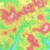
Wildflecken
Germany > Bavaria > Landkreis Bad Kissingen
Dubbed "The Top of the Rock" by American troops, the small post was among the most feared and disliked of all training areas due to high altitude and extreme weather conditions. It featured ranges for tanks, artillery and basic training facilities. Additionally, it was one of only a few training sites allowed…
Average elevation: 647 m
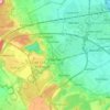



Pegnitz
Germany > Bavaria > Nürnberger Land > Hersbruck > Weiher
The Pegnitz has its source in the town of the same name at an altitude of 425 m (1,394 ft) and meets the Rednitz at 283 m (928 ft) in Fürth to form the Regnitz river. Shortly after the source, the Pegnitz unites with the 15 km (9.3 mi) long Fichtenohe while keeping the name of the shorter tributary. Some…
Average elevation: 357 m

Hof
Hof has an humid continental climate (Köppen: Dfb; Trewartha: Dclo). Hof is located at an altitude of 565.2 metres (1,854 ft), which is much cooler than other areas in Bavaria. The average annual temperature ranges from −1 °C (30 °F) in winter to 17 °C (63 °F) in summer, and the annual precipitation is…
Average elevation: 531 m
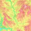
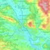
Breisach am Rhein
Germany > Baden-Württemberg > Landkreis Breisgau-Hochschwarzwald
Average elevation: 207 m
Bad Hersfeld
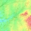
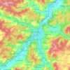
Germany > Hesse > Landkreis Hersfeld-Rotenburg
The Flugplatz Johannesberg has the status of Special Airfield. The runway, some 671 m long and 18 m wide, is paved with asphalt and oriented in a north–south direction. The airfield lies on the Johannesberg in the like-named outlying centre at an elevation of 284 m above sea level.
Average elevation: 305 m

Delitzsch
Germany > Saxony > Nordsachsen
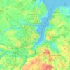
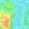
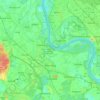
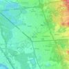
Delitzsch is located in the northwestern part of Nordsachsen in Saxony, at an altitude of 94 meters above sea level. Due to its location on the border with Saxony-Anhalt, Delitzsch is the northernmost town in Saxony. It is situated on the north heath and recreation area Goitzsche which extends across the…
Average elevation: 95 m

Laupheim
Germany > Baden-Württemberg > Landkreis Biberach
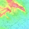
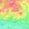
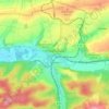
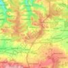
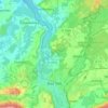
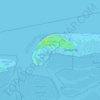
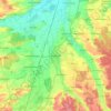
The elevation within the city confines ranges from 509 m (1670 ft) above sea level at the bottom of the valley to 539 m (1768 ft) in the outlying suburban areas.
Average elevation: 523 m
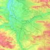
Nuremberg
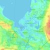
Nuremberg has an oceanic climate (Köppen Cfb) with a certain humid continental influence (Dfb), categorized in the latter by the 0 °C isotherm. The city's climate is influenced by its inland position and higher altitude. Winters are changeable, with either mild or cold weather: the average temperature is…
Average elevation: 336 m


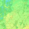


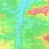
Erlangen
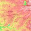
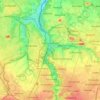
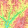
In 1435 the church, which had been the daughter church of St. Martin in Forchheim up until this point, was elevated to its own parish. The main task of the Erlangen priest was the pastoral care in the city of Erlangen and the St. Martin's Chapel on the Martinsbühl, which was now named for the first time.…
Average elevation: 300 m

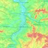
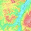
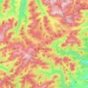
Winterberg
Germany > North Rhine-Westphalia > Hochsauerlandkreis
Winterberg experiences a humid continental climate (Köppen Dfb) like most of Germany, however also bordering on subarctic climate (Dfc), thanks to its altitude, with only having an average temperature above 10 °C and September only being barely above it. The summers are short and cool, while the winters are…
Average elevation: 627 m
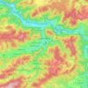
Plettenberg
Germany > North Rhine-Westphalia > Märkischer Kreis
Plettenberg is located to the west of the Sauerland hills. The highest elevation of the town area is in the Ebbe Mountains with 663 m above sea level, the lowest elevation with 194 m near Teindeln [de]. The town is spread out between the four valleys of the rivers Lenne, Else, Oester [arz; ceb; cv; de; zh] and…
Average elevation: 378 m
Illingen
Germany > Baden-Württemberg > Enzkreis
The municipality (Gemeinde) of Illingen is located at the eastern edge of the Enzkreis district, within the state of Baden-Württemberg and Federal Republic of Germany. It covers an area of 29.36 square kilometers (11.34 sq mi) that lies within the metropolitan areas of Karlsruhe and Pforzheim. Illingen is…
Average elevation: 279 m
Reichelsheim (Odenwald)
Germany > Hesse > Odenwaldkreis
Reichelsheim lies in the middle Odenwald at elevations between 200 and 538 m in the middle of the Geo-Naturpark Bergstraße-Odenwald.
Average elevation: 335 m

Hochstaufen
Germany > Bavaria > Landkreis Berchtesgadener Land > Bad Reichenhall
At an altitude of 1,750 m is the Reichenhaller Haus, an alpine hut of the Deutscher Alpenverein (Section Bad Reichenhall).
Average elevation: 1,115 m



Garmisch-Partenkirchen
Germany > Bavaria > Landkreis Garmisch-Partenkirchen
Garmisch-Partenkirchen leans towards an oceanic climate, and its winters are colder than the rest of Bavaria. Due to its higher elevation, it is very close to the winters associated with continental climates; it has a relatively wet and snowy climate, with high precipitation year-round. As of 2013 the regions…
Average elevation: 1,326 m