
Thank you for supporting this site ❤️
Make a donation
Make a donation
Creek County topographic map
Click on the map to display elevation.
Thank you for supporting this site ❤️
Make a donation
Make a donation
About this map
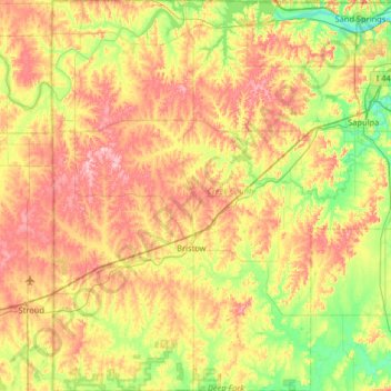
Name: Creek County topographic map, elevation, terrain.
Location: Creek County, Oklahoma, United States (35.63881 -96.62312 36.16438 -96.02863)
Average elevation: 255 m
Minimum elevation: 188 m
Maximum elevation: 338 m
Thank you for supporting this site ❤️
Make a donation
Make a donation
Other topographic maps
Click on a map to view its topography, its elevation and its terrain.