
Flühli topographic map
Interactive map
Click on the map to display elevation.
About this map
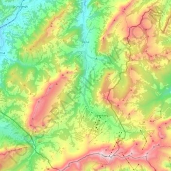
Name: Flühli topographic map, elevation, terrain.
Location: Flühli, Luzern, Zwitserland (46.77499 7.94786 46.91932 8.07159)
Average elevation: 1,411 m
Minimum elevation: 791 m
Maximum elevation: 2,313 m
Other topographic maps
Click on a map to view its topography, its elevation and its terrain.
Hasehuse
Zwitserland > Luzern > Beromünster > Hasehuse
Hasehuse, Beromünster, Luzern, 6221, Zwitserland
Average elevation: 712 m