
Reiden topographic map
Interactive map
Click on the map to display elevation.
About this map
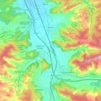
Name: Reiden topographic map, elevation, terrain.
Location: Reiden, Luzern, 6260, Zwitserland (47.19641 7.90999 47.26218 8.01752)
Average elevation: 556 m
Minimum elevation: 440 m
Maximum elevation: 765 m