
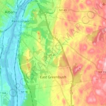
Town of East Greenbush topographic map
Interactive map
Click on the map to display elevation.
About this map
Name: Town of East Greenbush topographic map, elevation, terrain.
Average elevation: 89 m
Minimum elevation: -2 m
Maximum elevation: 213 m
Other topographic maps
Click on a map to view its topography, its elevation and its terrain.
City of Troy
United States > New York > Rensselaer County
City of Troy, Rensselaer County, New York, United States
Average elevation: 81 m
Troy
United States > New York > Rensselaer County
Troy, Rensselaer County, New York, 12181, United States
Average elevation: 137 m
Eagle Bridge
United States > New York > Rensselaer County > Town of Hoosick
Eagle Bridge, Town of Hoosick, Rensselaer County, New York, 12028, United States
Average elevation: 161 m
Town of Berlin
United States > New York > Rensselaer County
Town of Berlin, Rensselaer County, New York, United States
Average elevation: 482 m
East Greenbush
United States > New York > Rensselaer County > East Greenbush
East Greenbush, Town of East Greenbush, Rensselaer County, New York, United States
Average elevation: 97 m
Wynantskill
United States > New York > Rensselaer County
Wynantskill, Town of North Greenbush, Rensselaer County, New York, 12198, United States
Average elevation: 136 m
Schodack Center
United States > New York > Rensselaer County
Schodack Center, Town of Schodack, Rensselaer County, New York, 12033, United States
Average elevation: 117 m
Town of Sand Lake
United States > New York > Rensselaer County
Town of Sand Lake, Rensselaer County, New York, United States
Average elevation: 288 m
West Sand Lake
United States > New York > Rensselaer County > Town of Sand Lake
West Sand Lake, Town of Sand Lake, Rensselaer County, New York, 12196, United States
Average elevation: 181 m
Town of Petersburgh
United States > New York > Rensselaer County
Town of Petersburgh, Rensselaer County, New York, 12138, United States
Average elevation: 376 m
Averill Park
United States > New York > Rensselaer County > Town of Sand Lake
Averill Park, Town of Sand Lake, Rensselaer County, New York, United States
Average elevation: 246 m
Eagle Mills
United States > New York > Rensselaer County > Town of Brunswick
Eagle Mills, Town of Brunswick, Rensselaer County, New York, 12140, United States
Average elevation: 149 m
Town of Nassau
United States > New York > Rensselaer County
Town of Nassau, Rensselaer County, New York, 12062, United States
Average elevation: 167 m
Town of Pittstown
United States > New York > Rensselaer County
Town of Pittstown, Rensselaer County, New York, United States
Average elevation: 201 m
Speigletown
United States > New York > Rensselaer County > Town of Schaghticoke
Speigletown, Town of Schaghticoke, Rensselaer County, New York, 12182, United States
Average elevation: 136 m
Lansingburgh
United States > New York > Rensselaer County > City of Troy
Lansingburgh, City of Troy, Rensselaer County, New York, 12182, United States
Average elevation: 51 m
Walloomsac Dam
United States > New York > Rensselaer County > Town of Hoosick > Walloomsac
Walloomsac Dam, Walloomsac, Town of Hoosick, Rensselaer County, New York, 12133, United States
Average elevation: 191 m
Brainard
United States > New York > Rensselaer County > Town of Nassau
Brainard, Village of East Nassau, Town of Nassau, Rensselaer County, New York, 12024, United States
Average elevation: 216 m
Stephentown
United States > New York > Rensselaer County > Stephentown
Stephentown, Town of Stephentown, Rensselaer County, New York, 12168, United States
Average elevation: 311 m
Glass Lake
United States > New York > Rensselaer County > Town of Sand Lake
Glass Lake, Town of Sand Lake, Rensselaer County, New York, 12018, United States
Average elevation: 305 m
Town of Grafton
United States > New York > Rensselaer County
Town of Grafton, Rensselaer County, New York, United States
Average elevation: 393 m
Town of Brunswick
United States > New York > Rensselaer County
Town of Brunswick, Rensselaer County, New York, United States
Average elevation: 238 m
Buskirk
United States > New York > Rensselaer County
Buskirk, Rensselaer County, New York, 12028, United States
Average elevation: 152 m
Town of Schodack
United States > New York > Rensselaer County
Town of Schodack, Rensselaer County, New York, United States
Average elevation: 92 m
Town of Hoosick
United States > New York > Rensselaer County
Town of Hoosick, Rensselaer County, New York, United States
Average elevation: 242 m
Town of North Greenbush
United States > New York > Rensselaer County
Town of North Greenbush, Rensselaer County, New York, 12198, United States
Average elevation: 121 m
Village of Hoosick Falls
United States > New York > Rensselaer County > Town of Hoosick
Village of Hoosick Falls, Town of Hoosick, Rensselaer County, New York, 12090, United States
Average elevation: 166 m
Town of Poestenkill
United States > New York > Rensselaer County > Town of Poestenkill
Town of Poestenkill, Rensselaer County, New York, United States
Average elevation: 251 m
Poestenkill
United States > New York > Rensselaer County > Town of Poestenkill
Poestenkill, Town of Poestenkill, Rensselaer County, New York, 12140, United States
Average elevation: 194 m
Town of Stephentown
United States > New York > Rensselaer County
Town of Stephentown, Rensselaer County, New York, United States
Average elevation: 420 m
Nassau
United States > New York > Rensselaer County > Nassau
Nassau, Town of Nassau, Rensselaer County, New York, United States
Average elevation: 141 m
Burden Lake
United States > New York > Rensselaer County > Maple Grove
Burden Lake, Maple Grove, Town of Sand Lake, Rensselaer County, New York, United States
Average elevation: 224 m
Prospect Heights
United States > New York > Rensselaer County > Prospect Heights
Prospect Heights, Town of East Greenbush, Rensselaer County, New York, 12144-2920, United States
Average elevation: 43 m
Best
United States > New York > Rensselaer County > Best
Best, Town of East Greenbush, Rensselaer County, New York, 12016, United States
Average elevation: 167 m
Village of Schaghticoke
United States > New York > Rensselaer County > Town of Schaghticoke
Village of Schaghticoke, Town of Schaghticoke, Rensselaer County, New York, United States
Average elevation: 102 m