
Sassel topographic map
Interactive map
Click on the map to display elevation.
About this map
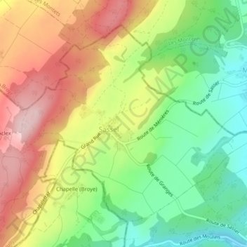
Name: Sassel topographic map, elevation, terrain.
Location: Sassel, Valbroye, District de la Broye-Vully, Vaud, 1534, Suisse (46.76640 6.84296 46.78800 6.87724)
Average elevation: 619 m
Minimum elevation: 495 m
Maximum elevation: 762 m
Other topographic maps
Click on a map to view its topography, its elevation and its terrain.
Combremont-le-Grand
Combremont-le-Grand, Valbroye, District de la Broye-Vully, Vaud, 1535, Suisse
Average elevation: 652 m
Combremont-le-Petit
Combremont-le-Petit, Valbroye, District de la Broye-Vully, Vaud, Suisse
Average elevation: 682 m