
Aiguille d'Argentière topographic map
Interactive map
Click on the map to display elevation.
About this map
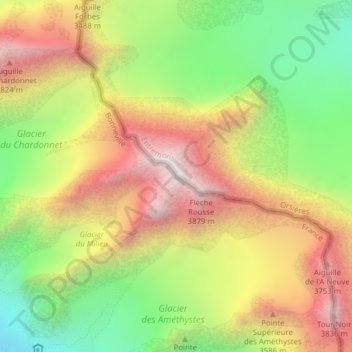
Name: Aiguille d'Argentière topographic map, elevation, terrain.
Location: Aiguille d'Argentière, Orsières, Entremont, Valais, 2303, Suisse (45.95963 7.02035 45.95973 7.02045)
Average elevation: 3,282 m
Minimum elevation: 2,694 m
Maximum elevation: 3,890 m
Other topographic maps
Click on a map to view its topography, its elevation and its terrain.