
Thank you for supporting this site ❤️
Make a donation
Make a donation
Lexington topographic map
Click on the map to display elevation.
Thank you for supporting this site ❤️
Make a donation
Make a donation
About this map
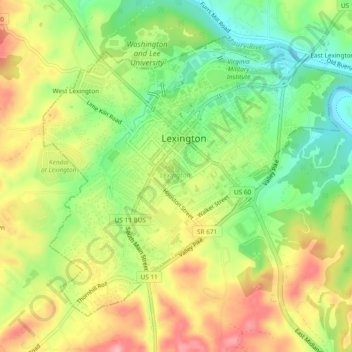
Name: Lexington topographic map, elevation, terrain.
Location: Lexington, Virginia, United States of America (37.76513 -79.46192 37.79484 -79.41495)
Average elevation: 331 m
Minimum elevation: 271 m
Maximum elevation: 397 m
Thank you for supporting this site ❤️
Make a donation
Make a donation
Other topographic maps
Click on a map to view its topography, its elevation and its terrain.