
Make a donation
Canary Islands topographic map
Click on the map to display elevation.
Make a donation
Canary Islands
The Canary Islands, especially Tenerife, Gran Canaria, Fuerteventura, and Lanzarote, are a major tourist destination, with over 12 million visitors per year. This is due to their beaches, subtropical climate, and important natural attractions, especially Maspalomas in Gran Canaria and Mount Teide (a World Heritage Site) in Tenerife. Mount Teide is the highest peak in Spain and the 4th tallest volcano in the world, measured from its base on the ocean floor. The islands have warm summers and winters warm enough for the climate to be technically tropical at sea level. The amount of precipitation and the level of maritime moderation vary depending on location and elevation. The archipelago includes green areas as well as desert. The islands' high mountains are ideal for astronomical observation, because they lie above the temperature inversion layer. As a result, the archipelago boasts two professional observatories: the Teide Observatory on Tenerife, and Roque de los Muchachos Observatory on La Palma.
Make a donation
About this map
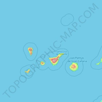
Name: Canary Islands topographic map, elevation, terrain.
Location: Canary Islands, Spain (27.43354 -18.39368 29.91180 -13.10126)
Average elevation: 13 m
Minimum elevation: 0 m
Maximum elevation: 3,432 m
Make a donation
Other topographic maps
Click on a map to view its topography, its elevation and its terrain.
Napal
Spain > Navarre > Zangozerria / Comarca de Sangüesa > Romanzado/Erromantzatua
Average elevation: 710 m
Make a donation
Make a donation
Parque Alcalde José Sánchez
Spain > Campo de Cartagena y Mar Menor > San Pedro del Pinatar > Los Peñascos
Average elevation: 7 m
Make a donation
Piedra del Águila
Spain > Andalusia > Comarca de Huéscar > Puebla de Don Fadrique
Average elevation: 1,295 m
Muleta
Spain > Aragon > Matarraña / Matarranya > Valderrobres / Vall de Roures
Average elevation: 1,131 m
Make a donation
Cerro de Fabián
Spain > Andalusia > Sierra de Cádiz > Villaluenga del Rosario
Average elevation: 736 m
Make a donation
Make a donation
San José
Spain > Castile-La Mancha > Montes de Toledo > San Martín de Montalbán
Average elevation: 704 m
Make a donation
Make a donation
Soil
Spain > Autonomous Community of the Basque Country > Montaña Alavesa/Arabako Mendialdea
Average elevation: 898 m
Cerro Teresa
Spain > Castile-La Mancha > Mesa de Ocaña > Santa Cruz de la Zarza
Average elevation: 774 m
Make a donation