
Rajasthan topographic map
Interactive map
Click on the map to display elevation.
About this map
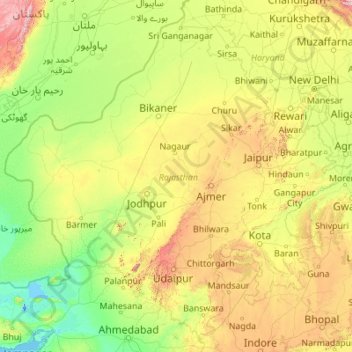
Name: Rajasthan topographic map, elevation, terrain.
Location: Rajasthan, Indien (23.06259 69.48444 30.19825 78.26120)
Average elevation: 254 m
Minimum elevation: -5 m
Maximum elevation: 2,299 m
Other topographic maps
Click on a map to view its topography, its elevation and its terrain.