
The Hogsback topographic map
Interactive map
Click on the map to display elevation.
About this map
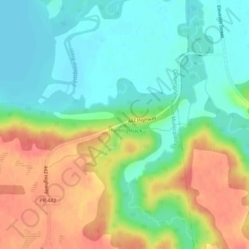
Name: The Hogsback topographic map, elevation, terrain.
Location: The Hogsback, Manitoba, Canada (49.19180 -99.09859 49.19190 -99.09849)
Average elevation: 427 m
Minimum elevation: 402 m
Maximum elevation: 463 m
Other topographic maps
Click on a map to view its topography, its elevation and its terrain.
Contour
Canada > Manitoba > Division No. 1 > Rural Municipality of Reynolds
Contour, Rural Municipality of Reynolds, Division No. 1, Manitoba, Canada
Average elevation: 299 m
Dickson Crecent Park
Canada > Manitoba > Winnipeg (city) > Winnipeg
Dickson Crecent Park, McGillivray Park, Fort Garry North, Winnipeg, Winnipeg (city), Manitoba, Canada
Average elevation: 234 m
Legislature
Legislature, Fort Rouge–East Fort Garry, Winnipeg, Manitoba, R3C 3R6, Canada
Average elevation: 235 m