
Thank you for supporting this site ❤️
Make a donation
Make a donation
Oglesby topographic map
Click on the map to display elevation.
Thank you for supporting this site ❤️
Make a donation
Make a donation
About this map
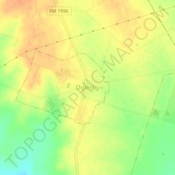
Name: Oglesby topographic map, elevation, terrain.
Location: Oglesby, Coryell County, Texas, United States (31.41266 -97.52019 31.42414 -97.50327)
Average elevation: 257 m
Minimum elevation: 234 m
Maximum elevation: 270 m
Thank you for supporting this site ❤️
Make a donation
Make a donation
Other topographic maps
Click on a map to view its topography, its elevation and its terrain.