
Thank you for supporting this site ❤️
Make a donation
Make a donation
Ben Bolt topographic map
Click on the map to display elevation.
Thank you for supporting this site ❤️
Make a donation
Make a donation
About this map
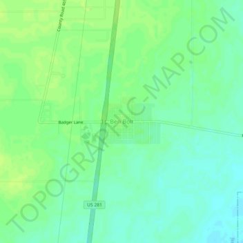
Name: Ben Bolt topographic map, elevation, terrain.
Location: Ben Bolt, Jim Wells County, Texas, 78342, United States (27.62753 -98.10139 27.66753 -98.06139)
Average elevation: 58 m
Minimum elevation: 50 m
Maximum elevation: 64 m
Thank you for supporting this site ❤️
Make a donation
Make a donation
Other topographic maps
Click on a map to view its topography, its elevation and its terrain.