
Alameda Central topographic map
Interactive map
Click on the map to display elevation.
About this map
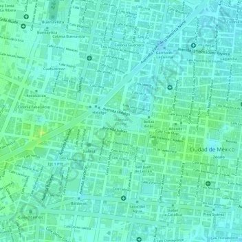
Name: Alameda Central topographic map, elevation, terrain.
Location: Alameda Central, Cuauhtémoc, Mexico City, Mexico (19.43449 -99.14618 19.43702 -99.14170)
Average elevation: 2,235 m
Minimum elevation: 2,229 m
Maximum elevation: 2,243 m
Other topographic maps
Click on a map to view its topography, its elevation and its terrain.
San Miguel Topilejo
San Miguel Topilejo, Mexico City, 14500, Mexico
Average elevation: 2,740 m
San Miguel Ajusco
San Miguel Ajusco, Mexico City, 14700, Mexico
Average elevation: 2,939 m