
Thank you for supporting this site ❤️
Make a donation
Make a donation
Klondike topographic map
Click on the map to display elevation.
Thank you for supporting this site ❤️
Make a donation
Make a donation
About this map
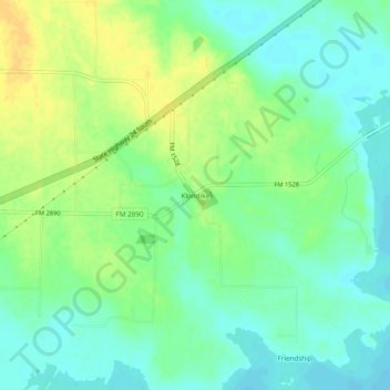
Name: Klondike topographic map, elevation, terrain.
Location: Klondike, Delta County, Texas, 75448, United States (33.30983 -95.77802 33.34983 -95.73802)
Average elevation: 142 m
Minimum elevation: 131 m
Maximum elevation: 156 m
Thank you for supporting this site ❤️
Make a donation
Make a donation
Other topographic maps
Click on a map to view its topography, its elevation and its terrain.
Cooper
United States > Texas > Delta County
Cooper is located at an elevation of 482 ft (147 m), a few miles north of Cooper Lake, between the north and south forks of the Sulphur River. It is located about 76 miles (122 km) northeast of Dallas and 94 miles (151 km) west of Texarkana. Texas State Highway 24 bypasses Cooper to the north; however, Texas…
Average elevation: 144 m