
Thank you for supporting this site ❤️
Make a donation
Make a donation
Ruinerwold topographic map
Click on the map to display elevation.
Thank you for supporting this site ❤️
Make a donation
Make a donation
About this map
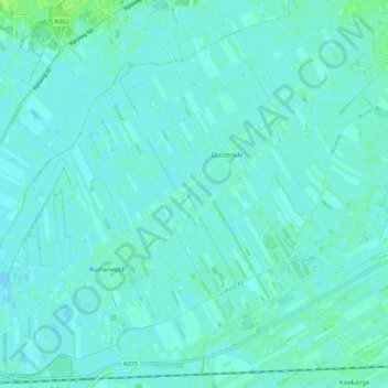
Name: Ruinerwold topographic map, elevation, terrain.
Location: Ruinerwold, De Wolden, Drenthe, Nederland (52.70292 6.21632 52.76691 6.32897)
Average elevation: 2 m
Minimum elevation: -2 m
Maximum elevation: 12 m
Thank you for supporting this site ❤️
Make a donation
Make a donation
Other topographic maps
Click on a map to view its topography, its elevation and its terrain.
Thank you for supporting this site ❤️
Make a donation
Make a donation
Thank you for supporting this site ❤️
Make a donation
Make a donation