
Thank you for supporting this site ❤️
Make a donation
Make a donation
Bananal Island topographic map
Click on the map to display elevation.
Thank you for supporting this site ❤️
Make a donation
Make a donation
About this map
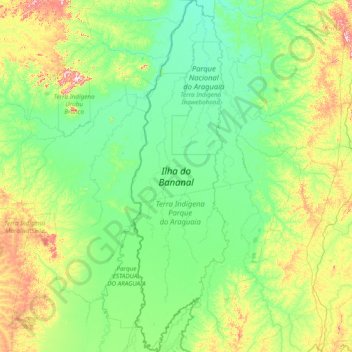
Name: Bananal Island topographic map, elevation, terrain.
Location: Bananal Island, Tocantins, North Region, Brazil (-12.86172 -50.73788 -9.84188 -49.88320)
Average elevation: 231 m
Minimum elevation: 164 m
Maximum elevation: 634 m
Thank you for supporting this site ❤️
Make a donation
Make a donation
Other topographic maps
Click on a map to view its topography, its elevation and its terrain.