
Saint-Servais topographic map
Interactive map
Click on the map to display elevation.
About this map
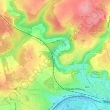
Name: Saint-Servais topographic map, elevation, terrain.
Location: Saint-Servais, Namur, Wallonie, 5002, Belgique (50.47055 4.81762 50.49267 4.86428)
Average elevation: 138 m
Minimum elevation: 79 m
Maximum elevation: 192 m
Other topographic maps
Click on a map to view its topography, its elevation and its terrain.