
Thank you for supporting this site ❤️
Make a donation
Make a donation
Somerset topographic map
Click on the map to display elevation.
Thank you for supporting this site ❤️
Make a donation
Make a donation
About this map
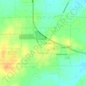
Name: Somerset topographic map, elevation, terrain.
Location: Somerset, Bexar County, Texas, United States (29.22034 -98.68023 29.24084 -98.63881)
Average elevation: 192 m
Minimum elevation: 176 m
Maximum elevation: 212 m
Thank you for supporting this site ❤️
Make a donation
Make a donation
Other topographic maps
Click on a map to view its topography, its elevation and its terrain.
Thank you for supporting this site ❤️
Make a donation
Make a donation
Thank you for supporting this site ❤️
Make a donation
Make a donation