
Thank you for supporting this site ❤️
Make a donation
Make a donation
South Dayton topographic map
Click on the map to display elevation.
Thank you for supporting this site ❤️
Make a donation
Make a donation
About this map
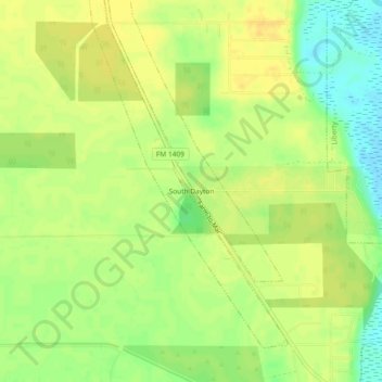
Name: South Dayton topographic map, elevation, terrain.
Location: South Dayton, Liberty County, Texas, 77535, United States (29.97744 -94.88548 30.01744 -94.84548)
Average elevation: 18 m
Minimum elevation: 2 m
Maximum elevation: 27 m
Thank you for supporting this site ❤️
Make a donation
Make a donation
Other topographic maps
Click on a map to view its topography, its elevation and its terrain.