
Tyrol topographic map
Click on the map to display elevation.
About this map
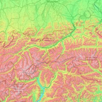
Name: Tyrol topographic map, elevation, terrain.
Location: Tyrol, Austria (46.65136 10.09783 47.74303 12.96600)
Average elevation: 1,410 m
Minimum elevation: 204 m
Maximum elevation: 3,800 m
Other topographic maps
Click on a map to view its topography, its elevation and its terrain.
Zöbing an der Raab
Austria > Styria > Bezirk Weiz > St. Margarethen an der Raab
Average elevation: 352 m