
Thank you for supporting this site ❤️
Make a donation
Make a donation
Red Bull Ring topographic map
Click on the map to display elevation.
Thank you for supporting this site ❤️
Make a donation
Make a donation
About this map
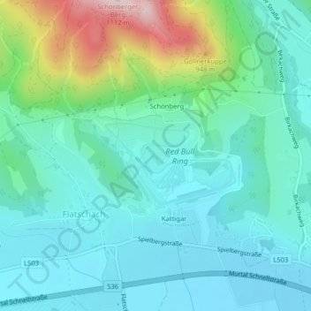
Name: Red Bull Ring topographic map, elevation, terrain.
Location: Red Bull Ring, Spielberg, Murtal, Styria, 824, Austria (47.21354 14.75046 47.23354 14.77046)
Average elevation: 755 m
Minimum elevation: 660 m
Maximum elevation: 1,089 m
Thank you for supporting this site ❤️
Make a donation
Make a donation