
Simanjiro topographic map
Interactive map
Click on the map to display elevation.
About this map
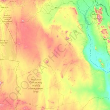
Name: Simanjiro topographic map, elevation, terrain.
Location: Simanjiro, Manyara Region, Northern Zone, Tanzania (-5.19547 36.29166 -3.45162 38.00090)
Average elevation: 1,111 m
Minimum elevation: 607 m
Maximum elevation: 2,068 m
Other topographic maps
Click on a map to view its topography, its elevation and its terrain.
Babati
Babati, Babati Municipal, Manyara Region, Northern Zone, Tanzania
Average elevation: 1,392 m
Kwa Kuchinia
Kwa Kuchinia, Babati, Manyara Region, Northern Zone, Tanzania
Average elevation: 1,004 m