
Thank you for supporting this site ❤️
Make a donation
Make a donation
Mount Rogers topographic map
Click on the map to display elevation.
Thank you for supporting this site ❤️
Make a donation
Make a donation
About this map
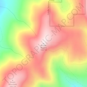
Name: Mount Rogers topographic map, elevation, terrain.
Location: Mount Rogers, Stevens County, Washington, United States (48.72620 -117.76715 48.72630 -117.76705)
Average elevation: 1,437 m
Minimum elevation: 1,077 m
Maximum elevation: 1,685 m
Thank you for supporting this site ❤️
Make a donation
Make a donation
Other topographic maps
Click on a map to view its topography, its elevation and its terrain.
Thank you for supporting this site ❤️
Make a donation
Make a donation
Thank you for supporting this site ❤️
Make a donation
Make a donation
Thank you for supporting this site ❤️
Make a donation
Make a donation