
Fahrland topographic map
Interactive map
Click on the map to display elevation.
About this map
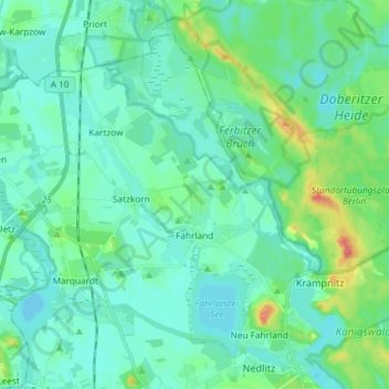
Name: Fahrland topographic map, elevation, terrain.
Location: Fahrland, Potsdam, Brandebourg, 14476, Allemagne (52.44041 12.95283 52.51469 13.09962)
Average elevation: 37 m
Minimum elevation: 25 m
Maximum elevation: 87 m
Other topographic maps
Click on a map to view its topography, its elevation and its terrain.
Babelsberg Süd
Allemagne > Brandebourg > Potsdam
Babelsberg Süd, Babelsberg, Potsdam, Brandebourg, 14482, Allemagne
Average elevation: 37 m