
Chetilla topographic map
Click on the map to display elevation.
About this map
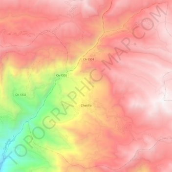
Name: Chetilla topographic map, elevation, terrain.
Location: Chetilla, Cajamarca, Perú (-7.18621 -78.70810 -7.08429 -78.60321)
Average elevation: 3,068 m
Minimum elevation: 1,329 m
Maximum elevation: 3,995 m
Other topographic maps
Click on a map to view its topography, its elevation and its terrain.