
Triège topographic map
Interactive map
Click on the map to display elevation.
About this map
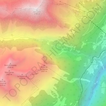
Name: Triège topographic map, elevation, terrain.
Location: Triège, Salvan, Saint-Maurice, Valais, 1923, Suisse (46.09971 6.95055 46.11154 7.00369)
Average elevation: 1,801 m
Minimum elevation: 722 m
Maximum elevation: 2,780 m
Other topographic maps
Click on a map to view its topography, its elevation and its terrain.