Geolocate
👉 Easily get elevation data in JSON, GeoTIFF and KML formats using Elevation API
Thank you for supporting this site ❤️
Make a donation

Shibei topographic map

Click on the map to display elevation.

👉 Easily get elevation data in JSON, GeoTIFF and KML formats using Elevation API
Thank you for supporting this site ❤️
Make a donation

About this map

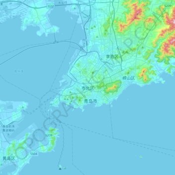
Name: Shibei topographic map, elevation, terrain.

Location: Shibei, Qingdao, Shandong, 266034, China (35.92740 120.21170 36.24740 120.53170)

Average elevation: 27 m

Minimum elevation: -6 m

Maximum elevation: 628 m

Other topographic maps

Click on a map to view its topography, its elevation and its terrain.

Guanxian County

China > Shandong

Average elevation: 41 m

Zibo

China > Shandong

Average elevation: 190 m

Feixian

China > Shandong

Average elevation: 183 m