
Make a donation
Mesa topographic map
Click on the map to display elevation.
Make a donation
About this map
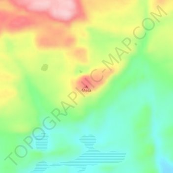
Name: Mesa topographic map, elevation, terrain.
Location: Mesa, Lago Buenos Aires, Santa Cruz Province, Argentina (-47.25971 -71.67209 -47.25961 -71.67199)
Average elevation: 475 m
Minimum elevation: 389 m
Maximum elevation: 597 m
Make a donation
Other topographic maps
Click on a map to view its topography, its elevation and its terrain.
El Calafate
Argentina > Santa Cruz Province
The most recent World Altitude Gliding record of 22,657 m (74,333 ft) was set near El Calafate on 2 September 2018 by Jim Payne and Tim Gardner in the new Perlan 2 glider (with pressurised cabin).
Average elevation: 432 m
Make a donation
El Calafate
Argentina > Santa Cruz Province
The most recent World Altitude Gliding record of 22,657 m (74,333 ft) was set near El Calafate on 2 September 2018 by Jim Payne and Tim Gardner in the new Perlan 2 glider (with pressurised cabin).
Average elevation: 432 m
Make a donation
El Calafate
Argentina > Santa Cruz Province
The most recent World Altitude Gliding record of 22,657 m (74,333 ft) was set near El Calafate on 2 September 2018 by Jim Payne and Tim Gardner in the new Perlan 2 glider (with pressurised cabin).
Average elevation: 249 m
Make a donation
Make a donation
Make a donation
El Calafate
Argentina > Santa Cruz Province
The most recent World Altitude Gliding record of 22,657 m (74,333 ft) was set near El Calafate on 2 September 2018 by Jim Payne and Tim Gardner in the new Perlan 2 glider (with pressurised cabin).[11]
Average elevation: 250 m
General Carrera Lake / Lake Buenos Aires
Argentina > Santa Cruz Province
The lake occupies a continental-scale graben formed by SWS-ENE normal faults that have resulted in down-dropping the bottom of the lake to 350 meters (1,150 ft) below mean sea level. Preservation of younger lithostratigraphic units within the graben form reverse stratigraphy with older units exposed at higher…
Average elevation: 893 m
Make a donation
Make a donation