
Thank you for supporting this site ❤️
Make a donation
Make a donation
Río Turbio topographic map
Click on the map to display elevation.
Thank you for supporting this site ❤️
Make a donation
Make a donation
About this map
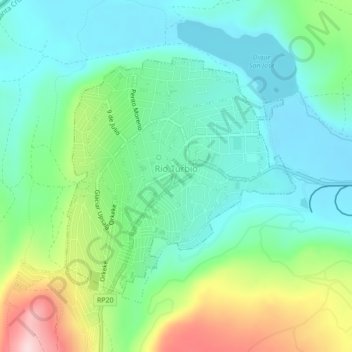
Name: Río Turbio topographic map, elevation, terrain.
Location: Río Turbio, Güer Aike, Santa Cruz Province, Argentina (-51.54662 -72.34967 -51.52841 -72.32121)
Average elevation: 346 m
Minimum elevation: 262 m
Maximum elevation: 552 m
Thank you for supporting this site ❤️
Make a donation
Make a donation
Other topographic maps
Click on a map to view its topography, its elevation and its terrain.