
Thank you for supporting this site ❤️
Make a donation
Make a donation
Ruinen topographic map
Click on the map to display elevation.
Thank you for supporting this site ❤️
Make a donation
Make a donation
About this map
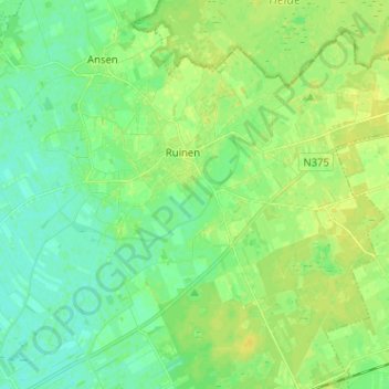
Name: Ruinen topographic map, elevation, terrain.
Location: Ruinen, De Wolden, Drenthe, Nederland (52.72319 6.30485 52.78832 6.43236)
Average elevation: 7 m
Minimum elevation: 0 m
Maximum elevation: 15 m
Thank you for supporting this site ❤️
Make a donation
Make a donation
Other topographic maps
Click on a map to view its topography, its elevation and its terrain.
Thank you for supporting this site ❤️
Make a donation
Make a donation
Thank you for supporting this site ❤️
Make a donation
Make a donation