
Thank you for supporting this site ❤️
Make a donation
Make a donation
Surister topographic map
Click on the map to display elevation.
Thank you for supporting this site ❤️
Make a donation
Make a donation
About this map
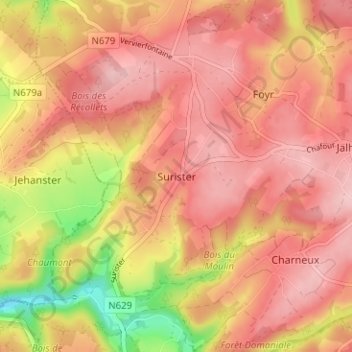
Name: Surister topographic map, elevation, terrain.
Location: Surister, Jalhay, Verviers, Liège, Wallonie, 4845, Belgique (50.53586 5.91352 50.57586 5.95352)
Average elevation: 346 m
Minimum elevation: 241 m
Maximum elevation: 396 m
Thank you for supporting this site ❤️
Make a donation
Make a donation
Other topographic maps
Click on a map to view its topography, its elevation and its terrain.