
Thank you for supporting this site ❤️
Make a donation
Make a donation
Bolland topographic map
Click on the map to display elevation.
Thank you for supporting this site ❤️
Make a donation
Make a donation
About this map
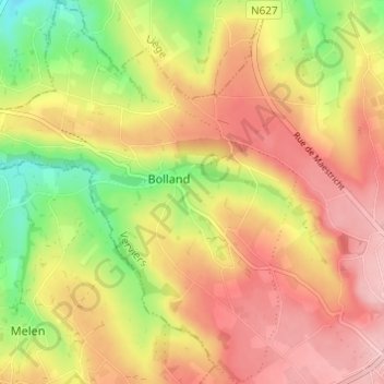
Name: Bolland topographic map, elevation, terrain.
Location: Bolland, Herve, Verviers, Liège, Wallonie, 4650, Belgique (50.64077 5.73002 50.67937 5.77988)
Average elevation: 247 m
Minimum elevation: 163 m
Maximum elevation: 310 m
Thank you for supporting this site ❤️
Make a donation
Make a donation
Other topographic maps
Click on a map to view its topography, its elevation and its terrain.