
Padang topographic map
Click on the map to display elevation.
About this map
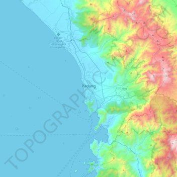
Name: Padang topographic map, elevation, terrain.
Location: Padang, West Sumatra, Sumatra, Indonesia (-1.13724 100.09884 -0.72629 100.56561)
Average elevation: 341 m
Minimum elevation: -1 m
Maximum elevation: 1,928 m
Other topographic maps
Click on a map to view its topography, its elevation and its terrain.