
Lac à Jim topographic map
Interactive map
Click on the map to display elevation.
About this map
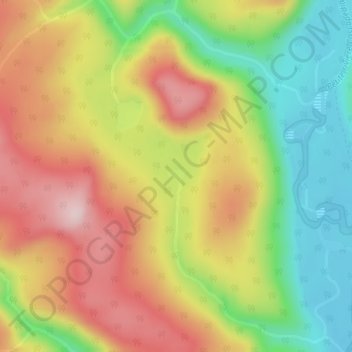
Name: Lac à Jim topographic map, elevation, terrain.
Average elevation: 296 m
Minimum elevation: 140 m
Maximum elevation: 455 m
Other topographic maps
Click on a map to view its topography, its elevation and its terrain.
Robidoux
Canada > Québec > Rivière-Bonaventure
Robidoux, Rivière-Bonaventure, Bonaventure, Gaspésie–Îles-de-la-Madeleine, Québec, Canada
Average elevation: 159 m
Mont Chauve
Canada > Québec > Rivière-Bonaventure
Mont Chauve, Rivière-Bonaventure, Bonaventure, Gaspésie–Îles-de-la-Madeleine, Québec, Canada
Average elevation: 145 m