
Yabassi topographic map
Interactive map
Click on the map to display elevation.
About this map
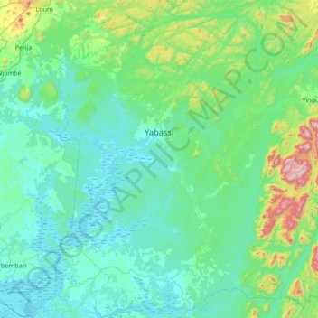
Name: Yabassi topographic map, elevation, terrain.
Location: Yabassi, Nkam, Région du Littoral, Cameroun (4.06670 9.75608 4.73819 10.28878)
Average elevation: 143 m
Minimum elevation: -1 m
Maximum elevation: 1,020 m
Other topographic maps
Click on a map to view its topography, its elevation and its terrain.