
Thank you for supporting this site ❤️
Make a donation
Make a donation
Krinkelt topographic map
Click on the map to display elevation.
Thank you for supporting this site ❤️
Make a donation
Make a donation
About this map
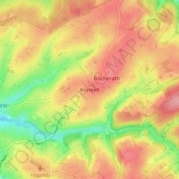
Name: Krinkelt topographic map, elevation, terrain.
Location: Krinkelt, Bullange, Verviers, Liège, Wallonie, 4761, Belgique (50.41184 6.27497 50.45184 6.31497)
Average elevation: 616 m
Minimum elevation: 554 m
Maximum elevation: 660 m
Thank you for supporting this site ❤️
Make a donation
Make a donation
Other topographic maps
Click on a map to view its topography, its elevation and its terrain.